Flood zones in Deerfield Beach and East Boca Raton: how to check your address before signing
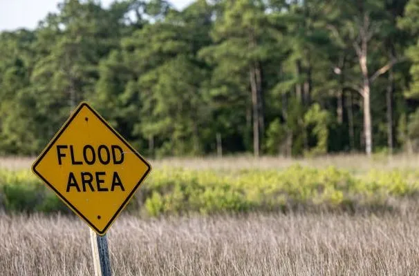
When renting or buying a home in South Florida, flood risk should be part of the property search, especially in coastal communities such as Deerfield Beach and East Boca Raton.
A property can look perfectly safe during a normal day but still have a flood designation that affects insurance costs, mortgage requirements, future resale, or the amount of protection you may want as a renter or homeowner.
Before signing a lease or purchase contract, take a few minutes to check the property's official flood information.
Why Flood Zones Matter When Renting or Buying in South Florida
When you are considering a home or rental property in South Florida, the flood zone should be part of your due diligence, not an afterthought.
A FEMA flood zone is a classification shown on official flood maps that helps indicate the level and type of flood hazard associated with a particular location. FEMA and the National Flood Insurance Program (NFIP) use these classifications to communicate flood risk and help determine flood insurance requirements and floodplain management standards.
This matters especially in coastal communities such as Deerfield Beach and Boca Raton, where properties can be affected by heavy rainfall, tropical storms, hurricanes, coastal flooding, and localized drainage problems.
What Is a Flood Zone?
Flood zones are geographic areas displayed on FEMA's Flood Insurance Rate Maps. They are used to describe different levels of potential flood hazard.
Some properties are located in a Special Flood Hazard Area (SFHA). These are areas FEMA identifies as having a 1% or greater annual chance of flooding, commonly associated with the so-called "100-year flood." High-risk zones can include A and V zone classifications.
Other properties may be mapped in moderate- or lower-risk areas, including certain B, C, and X zones.
The important point is that lower risk does not mean zero risk.
High-Risk Does Not Mean the Property Will Definitely Flood
A FEMA flood zone is a risk classification, not a prediction that a specific property will flood during the next storm.
An SFHA represents an area with a statistically significant flood hazard, but individual flooding can vary based on elevation, drainage, construction, surrounding development, storm intensity, and other conditions.
Likewise, being outside an SFHA does not guarantee that a home will remain dry.
FEMA's NFIP explains that everyone lives with some level of flood risk. Even properties in low- and moderate-risk zones can experience flooding.
Why Lower-Risk Zones Still Matter
One of the biggest mistakes prospective renters and buyers can make is assuming that a Zone X or other lower-risk designation means flooding is impossible.
It does not.
FEMA notes that localized flooding can occur outside high-risk flood areas. Heavy rainfall, poor drainage, ponding, and stormwater problems can cause flooding even when a property is not located in an SFHA.
In fact, the NFIP reports that a significant portion of flood insurance claims come from outside high-risk flood areas. The current FloodSmart guidance states that nearly one-third of NFIP claims occur outside high-risk areas.
That is an important reminder for anyone comparing homes based solely on FEMA flood-zone labels.
Why This Is Especially Important in South Florida
South Florida has characteristics that make flood risk an important consideration when evaluating property.
A property can potentially be affected by several types of flooding, including:
Heavy or prolonged rainfall
Tropical storms
Hurricanes
Coastal flooding
Storm surge
Localized street flooding
Poor or overwhelmed drainage
Water accumulating in low-lying areas
FEMA's flood-risk guidance considers multiple potential sources of flooding, including coastal water, heavy rainfall, rivers and lakes, as well as characteristics such as property elevation.
This means two homes in the same general neighborhood can have different practical flood risks depending on their elevation, construction, drainage conditions, and exact location.
Flood Zone Can Affect Insurance
Flood-zone information can also matter financially.
For properties in an SFHA, federal law generally requires flood insurance when the property is secured by a government-backed mortgage. However, flood insurance can also be purchased for properties outside high-risk areas, and FEMA recommends considering coverage because flooding can occur outside SFHAs.
Another important consideration is that standard homeowners insurance generally does not cover flood damage. Flood insurance is a separate form of coverage designed specifically for flood losses.
For renters, the same issue is worth understanding. Renters insurance may cover certain types of personal-property losses, but flood damage is generally not covered by a standard renters policy. A renter concerned about flood exposure should ask an insurance professional specifically about flood coverage.
Don't Stop at the FEMA Zone
A flood-zone designation is a useful starting point, but it should not be the only question you ask before renting or buying.
For a specific property, consider checking:
The FEMA flood zone
The property's elevation
Whether flood insurance is required
The estimated cost of flood insurance
Past flooding or water intrusion
Local drainage conditions
Whether the property is near canals, waterways, or the coast
The building's age and construction characteristics
Any previous flood-related repairs or claims disclosed by the owner
Whether FEMA has updated the flood map for the area
FEMA recommends checking flood maps periodically because flood hazards can change over time as development, drainage patterns, terrain, weather conditions, and other factors change.
What Renters Should Ask Before Signing a Lease
If you are renting a home, condo, or apartment in Deerfield Beach, Boca Raton, or another South Florida community, consider asking the landlord or property manager:
Has the property ever experienced flooding?
Has water ever entered the home, garage, or ground-level areas?
Is flood insurance carried on the property?
Are there any flood-related exclusions or requirements I should know about?
Which utilities or drainage systems are maintained by the property owner or HOA?
Is the building located in a FEMA high-risk flood zone?
Are there any known drainage issues in the neighborhood?
These questions can provide information that a simple listing description may not reveal.
What Buyers Should Do Before Closing
For buyers, flood risk deserves attention before committing to a property.
Check the FEMA flood map for the exact address and discuss the results with your lender and insurance professional. If the property is in a higher-risk area, obtain an actual flood insurance quote rather than assuming the cost will be insignificant.
It is also useful to look beyond the map itself. Visit the property after heavy rain when possible, inspect drainage around the home, and ask about previous flooding or water damage.
Remember that FEMA flood maps are designed to communicate flood hazard, but they cannot guarantee that a particular property will or will not flood.
Flood zones matter because they provide an important starting point for understanding a property's flood risk, insurance considerations, and potential financial exposure.
A property located in an SFHA deserves careful attention, but a property outside a high-risk zone should not automatically be considered flood-proof.
In South Florida, where heavy rainfall, tropical weather, coastal conditions, and drainage can all contribute to flooding, the smartest approach is to look at the whole picture.
Before signing a lease or purchasing a home, check the FEMA flood zone, investigate the property's history, understand the insurance implications, and evaluate the property's actual surroundings.
A lower-risk flood zone can reduce your risk, but it does not eliminate it.
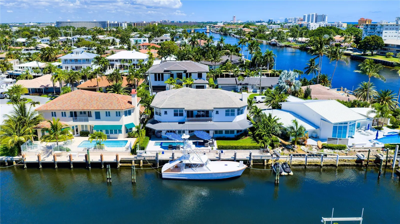
Deerfield Beach: Check the Current Broward County Flood Map Before Renting or Buying
If you are considering renting or buying a home in Deerfield Beach, checking the property's current FEMA flood zone should be an important part of your research.
Broward County's current FEMA Flood Insurance Rate Maps became effective on July 31, 2024. The county provides an interactive flood-map tool that allows residents, property owners, buyers, and renters to look up a specific property and review its current flood-zone designation.
Because flood designations can vary from one property to another, it is better to check the specific address and parcel rather than assuming that an entire neighborhood has the same flood classification.
Why the 2024 Flood Map Matters
The July 31, 2024 FEMA maps replaced or updated portions of the previous flood maps for Broward County.
This is important because a property's flood designation may have changed. In Deerfield Beach, the city reports that more than 1,327 properties were affected by the 2024 map revision, including properties that changed from Zone X to Zones AE or AH.
Not every property in Deerfield Beach was affected by the update, however. The city notes that some sections may still be governed by the previous August 18, 2014 flood map because those areas were not revised in 2024.
That is one reason it is important to check the actual property instead of relying on an older listing, previous insurance information, or what a neighbor says about the neighborhood.
How to Check a Deerfield Beach Property
Broward County's interactive flood-map tool provides a relatively straightforward way to check an address.
Start by entering the property location into the county's current flood-zone map. The map will identify the approximate location of the address.
Once the property appears, select the specific property or parcel on the map.
According to Broward County, the resulting information can show the FEMA flood designations associated with the property under the current July 31, 2024 map and, where applicable, the superseded August 18, 2014 map.
This parcel-level approach is important because flood-zone boundaries do not necessarily follow neighborhood boundaries.
Broward County Flood Zone Maps and Interactive Map
What Information Can You Find?
When you select a property on the Broward County map, several pieces of information may be available.
1. Current FEMA Flood Zone
The map can show the property's current FEMA flood designation under the July 31, 2024 flood maps.
Depending on the location, classifications can include zones such as AE, AH, VE, or X. These classifications represent different levels and types of flood hazard. Broward County's map materials explain that AE and AH are areas with a 1% annual chance of flooding, while X zones generally represent moderate or minimal flood risk depending on the specific designation.
2. Previous Flood-Zone Designation
The county's interactive tool can also show the property's previous flood designation from the superseded August 18, 2014 maps.
Comparing the current and previous designations can be useful if you are purchasing or renting a property whose flood classification has recently changed.
3. Base Flood Elevation
For applicable properties, the map can provide information about the Base Flood Elevation (BFE).
The BFE represents the elevation associated with the base flood, commonly referred to as the 1%-annual-chance flood. Broward County notes that the interactive map can display the applicable 100-year elevation or BFE for a selected parcel.
Elevation information can be particularly important when evaluating a property in a higher-risk flood zone.
4. FEMA Flood Map Panel
The property information can also identify the applicable FEMA flood-map panel.
This can help when reviewing official FEMA documents, elevation information, insurance questions, or other flood-related records connected with the property.
Deerfield Beach Has Additional Flood Information
The City of Deerfield Beach provides additional resources beyond the Broward County flood-zone map.
The city's flood-information page includes access to Elevation Certificates and information about Letters of Map Amendment (LOMAs).
An Elevation Certificate provides elevation measurements for a structure and surrounding property. The city collects certificates for properties where certain work requiring an elevation certificate has been performed and allows residents to search available certificates by address.
These documents can provide useful information that is not apparent from simply looking at the property's flood-zone label.
City of Deerfield Beach Flood Information
What Is a Letter of Map Amendment?
A Letter of Map Amendment, or LOMA, is another important document to investigate when a property appears to be in a Special Flood Hazard Area.
In certain circumstances, a property or structure may qualify for a FEMA determination that removes it from the Special Flood Hazard Area based on elevation information.
Deerfield Beach explains that property owners can review its LOMA information and that a property may qualify for a LOMA removal determination when the applicable elevations shown on the Elevation Certificate are at or above the base flood elevation.
However, a LOMA should not simply be assumed because a property appears elevated. The actual FEMA documentation and current map status should be reviewed.
The City of Deerfield Beach also maintains a 2024 LOMA revalidation list associated with the FEMA map update.
Contact the Deerfield Beach Floodplain Administrator
If you are unsure about a property's flood designation, Deerfield Beach provides assistance through its Floodplain Administrator.
The city states that its Floodplain Administrator can determine whether a property is located in a Special Flood Hazard Area. Written documentation is available upon request, and the city lists the Engineering Division at 200 Goolsby Boulevard and telephone number 954-250-4313 for assistance.
This can be especially useful when the online map, an older property document, and information from a landlord, seller, or insurance company appear to conflict.
Don't Rely Only on the Listing
Real estate listings can be useful for finding properties, but they should not be your final source for flood-zone information.
Before signing a lease or purchase contract, verify the current status yourself.
For a Deerfield Beach property, compare:
The property's exact address
The specific parcel on the Broward County map
The current July 31, 2024 FEMA flood designation
Any previous flood-zone designation
Base Flood Elevation information, if applicable
The FEMA map panel
Available Elevation Certificates
Any applicable LOMA or LOMR documentation
Current flood-insurance requirements and costs
This is especially important if the property recently changed flood zones.
What Renters Should Know
Renters may not be responsible for the building's flood insurance, but flood risk can still affect the cost and availability of a rental.
Before signing a lease, ask the landlord or property manager whether the property has experienced flooding and whether there are any known drainage or water-intrusion issues.
Also ask what type of insurance the property owner carries and whether you need additional coverage for your personal belongings.
Broward County encourages property owners and renters to consider flood insurance even when it is not mandatory because all areas have some degree of flood susceptibility.
What Buyers Should Do
For buyers, flood-map research should happen before closing, not after.
If the property is mapped into a high-risk area, discuss the implications with your lender and insurance professional. Broward County notes that federally regulated lenders generally require flood insurance when a structure securing a mortgage is located in a high-risk flood area.
Even if insurance is not required, obtaining a quote before purchasing can help you understand the property's true monthly and annual carrying costs.
If you are buying or renting in Deerfield Beach, check the current Broward County FEMA flood map for the exact property.
The current maps became effective on July 31, 2024, and some properties have different flood designations than they had under the previous maps.
Don't rely solely on a neighborhood name, an old listing, or a previous flood-zone designation.
Instead, locate the specific parcel, review the current FEMA designation, check the Base Flood Elevation when applicable, and investigate available Elevation Certificates and LOMA documentation.
A few minutes of research before signing a lease or purchasing a home can help you better understand the property's flood exposure, insurance implications, and potential financial risk.
East Boca Raton: Pay Attention to Updated Flood Maps
If you are renting or buying a property in East Boca Raton, flood-zone research deserves special attention. Properties closer to the Atlantic Ocean and Intracoastal waterways can have different flood considerations than properties farther inland.
One of the most important steps is to check the current FEMA flood designation for the specific property, rather than relying on an older real estate listing, a previous owner's information, or an insurance quote from several years ago.
Why East Boca Raton Deserves Extra Attention
Boca Raton's eastern areas are influenced by their proximity to the Atlantic Ocean, Intracoastal Waterway, canals, and other coastal features.
Coastal properties can face multiple types of flood exposure, including:
Storm surge
Coastal flooding
Heavy rainfall
Tropical storms and hurricanes
Drainage-related flooding
Flooding associated with nearby waterways
However, being close to the coast does not automatically mean that every property has the same FEMA flood classification.
Flood-zone boundaries can change from one property to another, which is why checking the exact address and parcel is so important.
Palm Beach County Updated Its FEMA Flood Information
Palm Beach County has updated its FEMA flood information, and the county reports that the revised flood maps became effective on December 20, 2024.
The updated mapping resulted in changes to flood-zone designations for properties throughout the county. According to Palm Beach County, some areas, particularly portions of eastern Palm Beach County, saw additional properties classified within higher-risk flood areas.
This is important for anyone looking at property in East Boca Raton because an older flood-zone designation may no longer reflect the property's current FEMA classification.
The county's flood-zone information is based on FEMA's Flood Insurance Rate Maps (FIRMs), which are used to identify areas with different levels of flood hazard.
Don't Rely on an Older Listing
Real estate listings can remain online for months or may be reused when a property is listed again.
That creates a potential problem if the listing contains outdated flood information.
For example, a listing might state that a property is in a lower-risk flood zone based on information available several years ago. If the FEMA map has since been updated, the property's current designation could be different.
Before signing a lease or purchase contract, verify the property using the most current available county and city resources.
The same principle applies to insurance information.
An insurance quote prepared for a previous owner or based on older flood-map information should not automatically be treated as the property's current insurance cost.
Check the Exact Boca Raton Address
The safest approach is to search for the specific property address.
The City of Boca Raton provides a flood-zone lookup tool that allows users to search an address and view FEMA Flood Insurance Rate Map information associated with the property.
This is useful because flood zones do not necessarily follow simple neighborhood boundaries.
Two homes located on nearby streets can potentially have different flood classifications.
When reviewing a property, pay attention to:
Current FEMA flood zone
FEMA Flood Insurance Rate Map information
Flood-map panel
Base Flood Elevation information, when applicable
Whether the property is located in a Special Flood Hazard Area
Any available elevation documentation
Whether flood insurance may be required
The potential cost of flood insurance
What Is a Special Flood Hazard Area?
A Special Flood Hazard Area (SFHA) generally refers to an area with a 1% or greater annual chance of flooding.
These areas are commonly associated with FEMA high-risk flood zones such as Zones A and V.
If a property is located in an SFHA, flood insurance requirements can become particularly important for buyers with a federally backed mortgage.
But buyers and renters should remember that properties outside an SFHA can still flood.
A lower-risk designation is not the same as a guarantee that flooding will never occur.
Why the Current Map Matters Financially
Flood-zone changes can affect more than just how a property is classified on a map.
They can also influence the property's overall cost of ownership.
For buyers, potential considerations include:
Flood insurance premiums
Mortgage-related insurance requirements
Construction or floodplain requirements
Property improvements
Resale considerations
For renters, flood risk can affect the property owner's insurance costs and may also influence what types of insurance a tenant should consider for personal belongings.
Before committing to a property, it is worth obtaining current insurance information rather than assuming the previous owner's costs will be the same.
What East Boca Raton Renters Should Ask
If you are renting an apartment, condo, townhouse, or single-family home in East Boca Raton, ask the landlord or property manager a few basic questions.
Has the property ever experienced flooding?
Past flooding can provide information that a FEMA map alone cannot.
Has the property's flood zone changed?
If the property was recently remapped, ask whether the landlord has documentation showing the current designation.
Is flood insurance carried on the building?
Find out what coverage the property owner maintains and what coverage, if any, is expected from the tenant.
Are there known drainage or water-intrusion issues?
A property can experience water problems even when it is not located in a high-risk FEMA zone.
What Buyers Should Do Before Making an Offer
If you are purchasing a home in East Boca Raton, flood-zone research should happen early in the buying process.
Start with the City of Boca Raton's flood-zone lookup and compare the property's information with the current Palm Beach County and FEMA mapping.
Then discuss the property with your insurance professional.
Ask for a current flood-insurance quote if there is any possibility that flood coverage will be necessary or beneficial.
It is also worth asking whether the property has an Elevation Certificate or other documentation that provides information about the structure's elevation.
Finally, investigate whether the property has experienced flooding or water intrusion in the past.
A Flood Map Is Only One Part of the Investigation
A FEMA flood map is an important resource, but it should not be the only information you consider.
For East Boca Raton properties, also pay attention to the property's:
Elevation
Distance from the coast
Proximity to canals and waterways
Drainage characteristics
Ground-floor or garage elevation
Previous flooding history
Building construction
Available flood insurance options
A property can have a lower-risk FEMA designation while still experiencing localized flooding during an extreme rainfall event.
If you are renting or buying in East Boca Raton, don't assume that an older flood-zone designation is still accurate.
Palm Beach County's updated FEMA flood information became effective December 20, 2024, and the updated maps changed flood classifications for properties in portions of the county.
Before signing a lease or purchasing a home, search the specific address using the current City of Boca Raton and Palm Beach County flood-map resources.
Then verify the insurance implications and investigate the property's actual flooding and drainage history.
The flood zone attached to an old listing is not necessarily the flood zone attached to the property today.
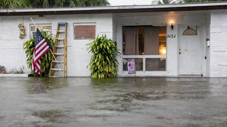
How to Check a Property’s Flood Risk Before Signing a Lease or Purchase Agreement in South Florida
Flood risk is an important part of evaluating a home, condominium, or rental property in Deerfield Beach, Boca Raton, and surrounding South Florida communities. A property can look perfectly dry during a showing and still have a flood-zone designation, elevation concerns, insurance implications, or a history of water intrusion.
Before signing a lease or purchase agreement, take the time to verify the property's flood information using official sources. Here is a practical step-by-step process.
Step 1: Get the Exact Property Address
Start with the complete property address, including:
Street number
Street name
Unit or apartment number
City
ZIP code
For condominiums and apartment buildings, identify the exact building and unit whenever possible. A large residential complex may contain multiple structures, and the structures may have different elevations, foundations, parking arrangements, or flood characteristics.
The more precise the address, the easier it is to make sure you are researching the correct property.
Step 2: Check the FEMA Flood Map
The FEMA Flood Map Service Center is the official public source for FEMA flood hazard maps and related products used in support of the National Flood Insurance Program. FEMA allows users to search for properties by address and access Flood Insurance Rate Maps and other flood information.
Enter the complete property address and identify the applicable flood zone.
Do not stop at a general map view. Zoom in and make sure the property itself is correctly located on the map. When available, check the effective date of the applicable Flood Insurance Rate Map as well.
For example, Broward County advises residents to use its current flood-zone mapping tools and specifically instructs users to locate their property and select the parcel to see the FEMA designation and available Base Flood Elevation information.
Step 3: Understand What the Flood Zone Means
A flood-zone designation should not be treated simply as a "safe" or "unsafe" label.
FEMA defines a Special Flood Hazard Area (SFHA) as an area subject to flooding from the base flood, which is the flood having a 1% chance of occurring or being exceeded in any given year. SFHAs include various A and V zones.
For coastal properties, V and VE zones are particularly important. FEMA identifies these as coastal areas with a 1% or greater annual chance of flooding and additional hazards associated with storm waves. VE zones can also have mapped Base Flood Elevations.
For federally backed mortgages, federal law generally requires flood insurance for buildings located in a Special Flood Hazard Area when the mandatory-purchase requirements apply.
Other zones may represent lower or different mapped levels of risk, but being outside an SFHA does not mean flooding is impossible. FEMA notes that flood risk can exist outside the areas mapped as Special Flood Hazard Areas.
The important question is:
What does the current designation mean for this specific property?
If you are unsure, ask the local floodplain office, insurance professional, lender, or qualified property professional to explain the designation.
Step 4: Look for the Base Flood Elevation
For properties in or near higher-risk flood areas, check whether a Base Flood Elevation (BFE) is available.
The BFE represents the elevation of the base flood and can be an important measurement when evaluating how the building's lowest occupied areas compare with the expected flood elevation. FEMA maps BFEs in several detailed flood zones, including AE and VE.
Broward County's current flood-map tools provide BFE information for applicable parcels. The county also states that BFEs must be used for new construction and substantial improvements to existing construction.
For a home you are considering buying, ask whether an Elevation Certificate is available.
An Elevation Certificate provides surveyed elevation information for a building and can help you and your insurance professional better understand the property's relationship to the applicable flood elevation.
Deerfield Beach maintains an online system for viewing available Elevation Certificates. The city explains that these certificates contain elevation measurements and are collected when property owners perform work requiring an elevation certificate.
Palm Beach County also maintains information about Elevation Certificates and advises property owners to confirm flood information through official sources before purchasing or constructing on a property.
Step 5: Check for a Letter of Map Change
Sometimes the current physical characteristics of a property may differ from what a flood map appears to show, or a property owner may have received an official FEMA determination affecting the property's mapped status.
One important example is a Letter of Map Amendment (LOMA).
A LOMA can be used when a property owner believes a property has been incorrectly included in a Special Flood Hazard Area because of its actual location or elevation.
The City of Boca Raton explains that property owners can submit a request to FEMA for a formal determination concerning a property's location or elevation relative to the Special Flood Hazard Area. If FEMA approves the map amendment, the owner may be able to request removal of the federal flood-insurance requirement from the lender.
Deerfield Beach also provides an interactive LOMA map and information about obtaining LOMA removal documentation. The city specifically advises property owners to review official documentation rather than relying on assumptions about a property's flood status.
If a seller or landlord tells you that a property is "not really in the flood zone," ask for the official FEMA documentation.
Do not rely solely on a verbal statement.
Step 6: Ask About Flood Insurance
Flood insurance is an important part of the financial picture when evaluating a property.
FEMA states that standard homeowners and renters insurance policies generally do not cover flood damage. Flood insurance is typically a separate form of coverage.
For a buyer, this can affect the total cost of owning the property.
Before committing to the purchase, ask an insurance agent for a flood-insurance quote. Do this before signing if possible, rather than assuming the cost will be minimal.
Insurance pricing can depend on more than the flood-zone designation. Factors can include:
Building elevation
Construction characteristics
Coverage limits
Deductible
Property location
Prior flood information
Building characteristics
For renters, ask whether the landlord's insurance covers only the building. Do not assume the property owner's policy covers your personal belongings.
Furniture, electronics, clothing, and other personal possessions may require your own renters or flood-related contents coverage depending on the circumstances and policy.
Step 7: Check More Than the Flood Zone
A FEMA flood-zone lookup is only one part of evaluating flood risk.
Before signing a lease or purchase agreement, consider asking:
Has the property flooded before?
Has water ever entered the home, garage, or building?
Is an Elevation Certificate available?
Is the property located in a Special Flood Hazard Area?
Is flood insurance required by the lender?
What would flood insurance cost?
Are there previous flood claims or significant water-damage repairs?
Does the HOA or condominium association have flood-related insurance requirements?
Are there drainage or stormwater issues around the property?
Is the parking area or garage particularly vulnerable to flooding?
Are there flood-related assessments or planned improvements for the building or community?
For properties in Boca Raton and eastern Palm Beach County, it is especially important to check the latest mapping information. Palm Beach County reports that updated FEMA maps became effective December 20, 2024, and that thousands of additional properties in eastern areas were placed into higher-risk flood zones. The county also reported that more than 16,000 parcels would experience an increase in BFE of one foot or more.
Deerfield Beach has also experienced important flood-map changes. The city reports that FEMA's updated maps became effective July 31, 2024, and that more than 1,327 Deerfield Beach properties were affected by the map revision.
That is why an older listing, previous flood-zone statement, or outdated map may not tell you the whole story.
Don't Forget the Hurricane Evacuation Zone
For coastal South Florida properties, check the hurricane evacuation zone separately from the FEMA flood zone.
These are not the same designation and they serve different purposes.
A FEMA flood zone describes mapped flood hazards and is used for purposes including floodplain management and flood-insurance requirements. A hurricane evacuation zone is used for emergency planning and evacuation decisions.
Palm Beach County provides separate tools for checking evacuation zones and flood zones.
A Smart Final Step Before Signing
Before you commit to a property, create a simple flood-risk file containing:
The exact property address
Current FEMA flood-zone information
The effective map date
Base Flood Elevation information, if available
Elevation Certificate, if available
Any FEMA LOMA or other Letter of Map Change
A flood-insurance quote
Information about previous flooding or water damage
HOA or condominium flood-insurance requirements
Hurricane evacuation-zone information
This process can take a little extra time, but it can help prevent an unpleasant financial surprise after you move in or close on the property.
Final Takeaway
Do not judge flood risk by appearance alone.
A property can look completely dry, sit several blocks from the water, or be outside what appears to be an obvious flood-prone area and still have important flood-related considerations.
For buyers and renters in Deerfield Beach, Boca Raton, and other South Florida communities, the safest approach is to verify the exact property address, check the current FEMA flood map, investigate BFE and Elevation Certificate information, look for LOMA or other official map-change documentation, obtain an insurance quote, and ask about the property's actual flooding history.
Official government sources should take priority over statements in a listing, information from an old real-estate advertisement, or verbal assurances from a seller or landlord.
Renters Should Check Flood Risk Too: What to Ask Before Renting in Deerfield Beach or East Boca Raton
Flood-zone research is not only for homebuyers. Renters in Deerfield Beach and East Boca Raton should also consider flood risk before signing a lease.
A rental property can look attractive because it is close to the beach, has a desirable view, or offers convenient parking. However, flooding can affect much more than the building itself. It can create problems for your belongings, renters insurance, parking, access to the property, and your ability to safely get home during a major storm.
The good news is that renters can take several practical steps to understand the risks before moving in.
Why Flood Risk Matters to Renters
Renters sometimes assume that flood risk is primarily the landlord's responsibility because the landlord owns the building.
That is only part of the picture.
The landlord may have insurance covering the structure, but that does not automatically mean your personal belongings are protected.
Furniture, electronics, clothing, computers, appliances, and other personal possessions can be expensive to replace after flood damage. FEMA explains that standard homeowners and renters insurance generally does not cover flood damage, making separate flood insurance an important consideration for people with significant personal property.
Flooding can also create indirect problems, including:
Parking restrictions
Flooded garages
Water entering storage areas
Road closures
Difficulty getting to or leaving the property
Temporary loss of access to the building
Storm-related power or utility interruptions
Damage to personal vehicles
Evacuation requirements
That means renters should evaluate the property and surrounding area, not just the apartment's interior.
Start With the Exact Rental Address
Before signing a lease, get the complete address of the property.
For an apartment or condominium, include the:
Street number
Street name
Building or tower
Unit number
City
ZIP code
This is particularly important in large condominium and apartment communities. Multiple buildings can be located on the same property but have different elevations, parking arrangements, entrances, or exposure to flooding.
Once you have the exact address, check the current FEMA flood map.
The FEMA Flood Map Service Center allows users to search for a property and review official flood-hazard information. It should be one of the first resources renters use when researching a property.
Ask About First-Floor Units
If you are considering a first-floor apartment, ask specific questions about previous flooding.
For example:
Has water ever entered the first-floor units or common areas?
Also ask whether flooding has affected:
Hallways
Elevators
Building entrances
Electrical equipment
Storage rooms
Parking areas
Mechanical rooms
A first-floor unit may have a different exposure to flooding than an upper-floor unit in the same building.
Don't assume that because the apartment itself has never flooded, the property has no flood-related problems. Access roads, parking lots, garages, or common areas may still be vulnerable.
Check the Parking Area and Garage
Parking can be an overlooked flood-risk issue for renters.
If your rental includes a ground-level garage or outdoor parking, ask:
Has the parking area flooded previously?
Has water entered the garage?
Have residents had to move vehicles during storms?
Is parking temporarily restricted during major weather events?
Are storage lockers or personal items kept in areas vulnerable to flooding?
A vehicle can be one of a renter's most valuable possessions.
If a property has a low-lying parking area, knowing how management handles flooding before a storm can help you prepare.
Ask the Landlord or Property Manager About Previous Flooding
A flood map tells you about mapped flood hazards, but it does not necessarily tell you everything about the property's actual history.
Ask the landlord or property manager directly:
"Has this property or building experienced flooding in the past?"
You can also ask:
Has water ever entered the building?
Has the parking garage flooded?
Have tenants ever had to evacuate?
Has the building experienced significant storm damage?
Have flood-related repairs been performed?
Are there drainage problems around the property?
Does the building have a storm or hurricane preparation procedure?
Whenever possible, ask for specific information rather than accepting a general answer such as "we have never had a problem."
Check Your Renters Insurance
Renters should understand exactly what their insurance policy covers.
Standard renters insurance generally does not cover flood damage to personal belongings. FEMA recommends discussing flood coverage with an insurance agent if you want protection against flood-related losses.
Ask an insurance professional about:
Personal-property coverage
Flood coverage
Deductibles
Coverage limits
Temporary living expenses
Water-damage exclusions
Coverage for electronics and other valuable belongings
Do not assume that the landlord's insurance covers your possessions.
The landlord's policy generally protects the owner's interest in the building, while your renters insurance is designed to address your personal property and other tenant-related risks according to the policy terms.
Don't Confuse Flood Zones With Hurricane Evacuation Zones
Renters in coastal communities should also check the property's hurricane evacuation zone.
A FEMA flood zone and a hurricane evacuation zone are different things.
A FEMA flood zone relates to mapped flood hazards and is used for floodplain management and other purposes, including federal flood-insurance requirements in applicable circumstances.
An evacuation zone is used for emergency planning and helps authorities determine which areas may need to evacuate during a hurricane or other major storm.
For coastal renters in Deerfield Beach and East Boca Raton, it is useful to know both.
Think About Access, Not Just Water Inside the Apartment
One of the biggest mistakes renters can make is focusing only on whether water has entered the unit.
Flooding around the property can still cause major disruption.
For example, your apartment may remain completely dry while:
The road leading to the building floods
The parking lot becomes inaccessible
A garage is closed
Public transportation is disrupted
Nearby businesses close
Emergency access becomes limited
You are unable to safely drive to work
Evacuation orders affect the neighborhood
For renters who commute to work or school, this can be just as important as the condition of the apartment itself.
East Boca Raton and Deerfield Beach Renters Should Pay Attention to Updated Maps
Flood maps can change, so renters should avoid relying on an old listing or information from a previous tenant.
Broward County provides current flood-zone information and encourages property owners and residents to check the applicable flood zone for their specific property.
Palm Beach County also provides official flood information and mapping resources for properties in the county. The county notes that updated FEMA flood information can affect properties and that residents should use current official information when evaluating flood risk.
This is particularly important in East Boca Raton, where coastal location and proximity to waterways can make flood information an important part of evaluating a rental.
A Simple Flood-Risk Checklist for Renters
Before signing your lease, ask yourself:
Do I have the exact property address and unit number?
Did I check the property on the current FEMA flood map?
Do I know the property's flood-zone designation?
Is the unit on the first floor?
Has the building experienced flooding before?
Has the parking area or garage flooded?
Could flooding affect access to the property?
Do I know whether my renters insurance covers flood damage?
Have I asked about previous water damage?
Do I know the property's hurricane evacuation zone?
Does the HOA or condominium association have storm-related rules?
Have I asked how management handles major storms?
Renters should check flood risk before signing a lease, not after the first major storm.
A rental near the beach can be an excellent choice, but location should not be the only consideration.
In Deerfield Beach and East Boca Raton, take a few minutes to check the current flood map, ask about the building's history, inspect the parking and garage arrangements, understand your insurance coverage, and determine whether flooding could affect access to the property.
The goal is not necessarily to avoid every property in a mapped flood area. Instead, the goal is to understand the risk and the potential costs before you commit to the lease.
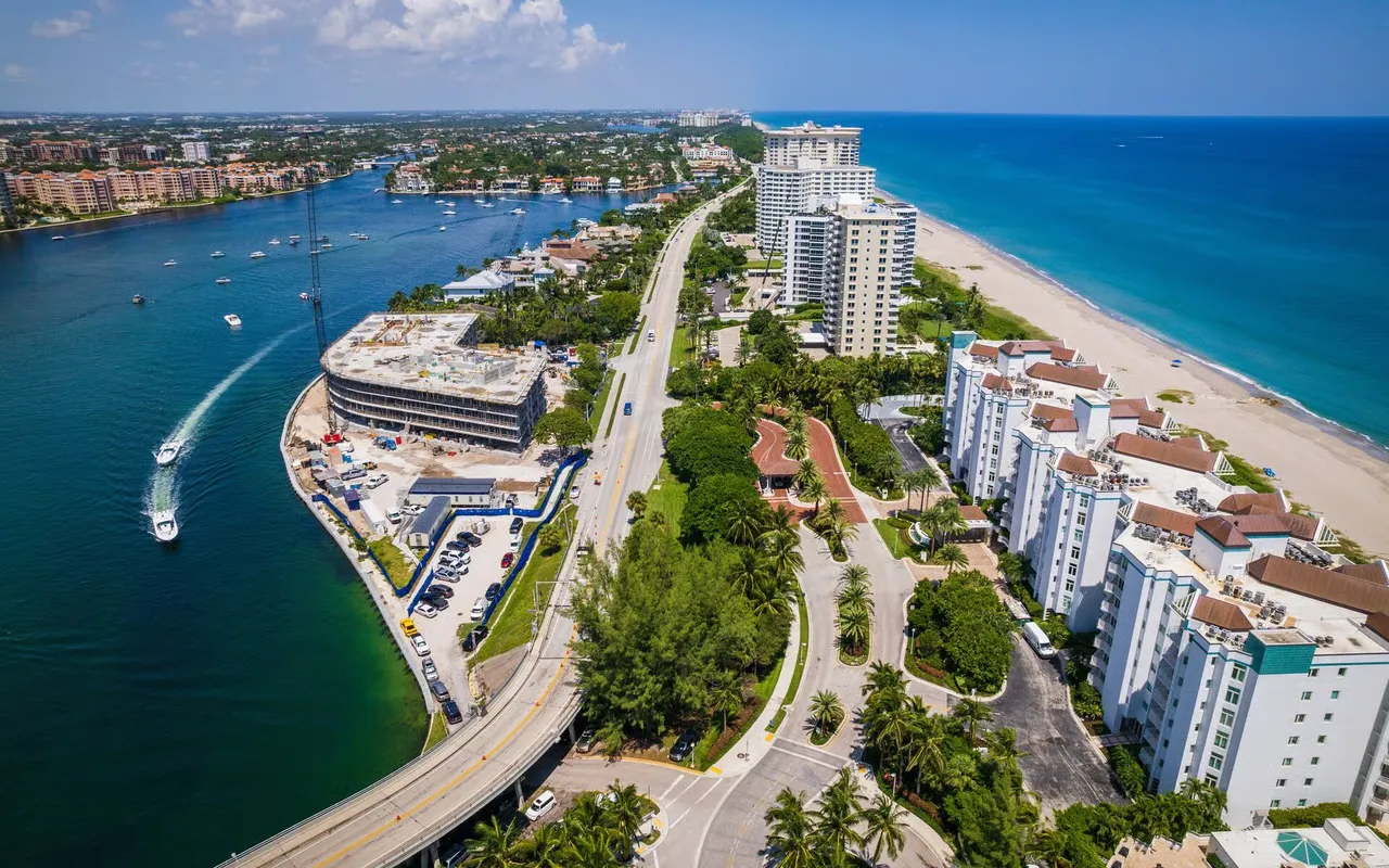
Don’t Rely Only on the Listing: How to Verify Flood Risk Before Renting or Buying in Deerfield Beach and Boca Raton
Real estate and rental listings are useful starting points when you are searching for a home, condominium, or apartment. They can help you compare prices, locations, amenities, and property features.
However, a listing should not be your final source for flood information.
Flood maps can be updated, properties can receive official map-change determinations, and individual buildings can have different characteristics from nearby properties. A listing may also contain information that was prepared before a newer FEMA flood map became effective.
If you are considering a property in Deerfield Beach or East Boca Raton, take the extra step of verifying the property's flood information through official government sources.
Why You Should Verify the Listing
A listing might say:
"Not in a flood zone"
"Low flood risk"
"No flood insurance required"
"Flood zone X"
"Flood-free property"
Those statements may be useful clues, but they should not automatically be treated as definitive.
FEMA's Flood Map Service Center is the official public source for flood-hazard information produced in support of the National Flood Insurance Program. FEMA's system allows users to search by address and access current and historical flood maps, Flood Insurance Rate Maps, and Letters of Map Change.
That makes the exact property address much more important than a short description in a real-estate advertisement.
Flood Maps Can Change
One reason not to rely on an old listing is that flood maps can be revised.
FEMA explains that flood maps may be updated, corrected, or changed over time.
This matters in South Florida because flood mapping can affect properties differently within the same neighborhood.
For example, the City of Boca Raton states that FEMA adopted new Flood Insurance Rate Maps on December 20, 2024. The city encourages residents and businesses to understand how the updated maps may affect their properties.
As a result, an older rental listing or sales listing may not accurately reflect the property's current mapped flood status.
Deerfield Beach: Check the City's Current Information
If you are looking at a property in Deerfield Beach, check both the city's flood information and the applicable Broward County/FEMA mapping resources.
The City of Deerfield Beach provides flood information, elevation certificates, LOMA information, and flood-zone resources. The city's current flood information page states that the Broward FEMA flood map effective July 31, 2024 applies to affected portions of Deerfield Beach, while the older August 18, 2014 map may still apply in areas that were not affected by the 2024 changes.
This is a good example of why simply reading "Zone X" or another designation in a listing is not enough.
The city's GIS resources also provide interactive information for flood zones and elevation certificates, while warning users to verify information before relying on the maps.
City of Deerfield Beach Flood Information
City of Deerfield Beach GIS Maps & Data
Boca Raton: Check the City and Palm Beach County Resources
For properties in Boca Raton, start with the city's Know Your Flood Zone resources and then verify the information through FEMA.
The City of Boca Raton provides a flood-zone lookup, information about Special Flood Hazard Areas, Elevation Certificates, and Letters of Map Amendment. The city also notes that a large portion of Boca Raton is located within FEMA-designated Special Flood Hazard Areas.
The city maintains additional floodplain-management information and encourages residents to consider flood insurance and understand their individual flood risk.
City of Boca Raton: Know Your Flood Zone
City of Boca Raton: Floodplain Management
For properties in Palm Beach County, it is also useful to consult the county's flood-information resources and verify the property's current FEMA mapping.
Check the Exact Building and Unit
This is particularly important for condominiums and large apartment communities.
Do not simply research the street address and assume every building has identical flood characteristics.
Ask for the:
Complete street address
Building or tower number
Unit number
ZIP code
Then make sure the property you are researching on the map corresponds to the actual building you intend to rent or purchase.
Two buildings within the same development can have different elevations, construction characteristics, parking arrangements, or exposure to flooding.
Look for a Letter of Map Change
A property may also have an official FEMA map-change determination.
For example, a property owner may have obtained a Letter of Map Amendment (LOMA).
The City of Boca Raton explains that property owners who believe a property has been incorrectly included in a Special Flood Hazard Area can request a formal FEMA determination.
Deerfield Beach also provides information about LOMAs and maintains an interactive map of LOMA properties. The city notes that certain properties may qualify for LOMA removal documentation based on elevation information.
Therefore, if a seller or landlord says:
"The listing says it's in a flood zone, but the property was removed."
Ask to see the official documentation.
A verbal explanation is not the same as an official FEMA determination.
Ask for an Elevation Certificate When Appropriate
An Elevation Certificate can provide additional information about a building's elevation in relation to the applicable flood elevation.
For example, Deerfield Beach provides access to available Elevation Certificates through its flood-information resources.
Boca Raton also maintains Elevation Certificates for certain new or substantially improved structures located in Special Flood Hazard Areas.
If you are seriously considering buying a property, ask whether an Elevation Certificate is available and have your insurance professional explain how the information could affect coverage and pricing.
Don't Confuse the Listing With an Insurance Quote
Another common mistake is assuming that a listing's statement about flood insurance tells you what you will actually pay.
Insurance requirements and premiums can depend on several factors, including the property's flood zone, building characteristics, elevation, coverage, deductible, and lender requirements.
If you are buying, obtain an insurance quote before committing to the property.
If you are renting, ask what insurance the landlord carries and what you need to insure yourself.
The City of Boca Raton notes that flood insurance is available to renters as well as property owners and businesses.
What Renters and Buyers Should Ask
Before signing a lease or purchase agreement, consider asking the landlord, seller, agent, HOA, or property manager:
What is the property's current FEMA flood-zone designation?
When was the current flood map issued?
Has the property ever received a LOMA or other Letter of Map Change?
Is an Elevation Certificate available?
Has the building flooded previously?
Has the garage or parking area flooded?
Have there been significant flood-related repairs?
Does the HOA or condominium association carry flood insurance?
Could the property require additional flood insurance?
Could flooding affect access to the building or parking area?
The answers can help you distinguish between a simple listing statement and verified property information.
A Better Way to Research a Property
Instead of relying on one source, use several sources together:
1. Start With the Listing
Use the listing to identify the property and gather basic information.
2. Verify the Exact Address
Make sure you have the correct building and unit.
3. Check FEMA
Use FEMA's Flood Map Service Center to review the official flood map and applicable flood products.
4. Check the Local Government
For Deerfield Beach, review the city's flood information and GIS resources.
For Boca Raton, review the city's flood-zone and floodplain-management resources.
5. Check for Map Changes
Look for LOMAs, Letters of Map Revision, or other official documentation that may affect the property's mapped status.
6. Ask About the Actual Building
Find out whether the property has experienced flooding, drainage problems, garage flooding, or other water-related issues.
7. Get an Insurance Quote
If you are buying, obtain insurance information before finalizing the transaction. If you are renting, determine whether your personal belongings require additional flood coverage.
Don't rely only on the listing when evaluating flood risk.
A listing is designed to market a property, while official flood maps and government records provide the information you should use to verify its flood status.
In Deerfield Beach, check the city's current flood information and GIS resources along with Broward County and FEMA information.
In Boca Raton and East Boca Raton, use the city's flood-zone resources, Palm Beach County information, and FEMA's official Flood Map Service Center.
Most importantly, research the exact property, not just the neighborhood.
A few additional minutes of verification before signing a lease or purchase agreement can help you understand the property's flood risk, insurance considerations, and potential storm-related problems before they become your problem.
A Simple Pre-Signing Flood Check for Deerfield Beach and East Boca Raton
Before signing a lease or purchase agreement in Deerfield Beach or East Boca Raton, take a few minutes to check the property's flood risk.
Flooding can affect more than the property itself. It can influence insurance costs, parking, access to the building, personal belongings, and the overall cost of renting or owning the property.
A listing may provide useful information, but it should not be your only source. The safest approach is to verify the property through FEMA, the applicable city or county, an insurance professional, and the property's owner or association.
Use the following 12-step checklist before committing.
1. Get the Exact Address
Start with the complete property address.
Make sure you have:
Street number
Street name
Unit number
Building or tower number, if applicable
City
ZIP code
For condominiums and large apartment communities, the exact building and unit are particularly important. Do not assume every building in the same complex has identical flood characteristics.
2. Search the Property on the Current FEMA Flood Map
Use the FEMA Flood Map Service Center to search for the property.
FEMA's Flood Map Service Center provides official flood-hazard information and allows users to search for properties and review applicable flood maps and related products.
Make sure you are looking at the actual property location on the map rather than relying on a general neighborhood view.
3. Check the Local County or City Flood-Zone Lookup
After checking FEMA, review the applicable local government resources.
For Deerfield Beach, check the City of Deerfield Beach's flood information and Broward County flood-map resources. The city provides information about flood zones, Elevation Certificates, Letters of Map Amendment, and current FEMA mapping.
For East Boca Raton, check the City of Boca Raton's flood-zone resources and Palm Beach County information in addition to FEMA's maps. Boca Raton provides local information about FEMA flood zones, Special Flood Hazard Areas, Elevation Certificates, and map amendments.
Using both federal and local sources gives you a more complete picture.
4. Identify the Current Flood-Zone Designation
Write down the property's current flood-zone designation.
Do not simply record "in a flood zone" or "not in a flood zone."
Different FEMA zones represent different levels and types of mapped flood hazards.
For example, FEMA identifies V and VE zones as coastal areas with a 1% or greater annual chance of flooding and additional hazards associated with storm waves.
Other zones can have different characteristics and requirements.
If you do not understand the designation, ask the local floodplain office, insurance agent, lender, or qualified property professional to explain what it means for the specific building.
5. Check the Base Flood Elevation if Applicable
For properties where a Base Flood Elevation (BFE) is available, record the applicable elevation.
The BFE represents the elevation of the base flood and can be important when evaluating the relationship between the building's elevation and the expected flood elevation.
Broward County's flood-map resources provide BFE information for applicable properties.
This information can also be useful to an insurance professional when evaluating the property's flood risk.
6. Ask Whether an Elevation Certificate Exists
Ask the seller, landlord, property manager, or condominium association whether an Elevation Certificate is available.
An Elevation Certificate provides surveyed information about a building's elevation and can be useful when evaluating flood risk and insurance.
The City of Deerfield Beach provides access to available Elevation Certificates through its flood-information resources.
Boca Raton also provides Elevation Certificate information for applicable properties.
If one exists, keep a copy with your property records.
7. Check for a LOMA or Other FEMA Map-Change Documentation
Ask whether the property has ever received a Letter of Map Amendment (LOMA) or another FEMA map-change determination.
A LOMA may affect how a specific property is treated in relation to a Special Flood Hazard Area.
The City of Boca Raton provides information about LOMA applications for property owners who believe their property has been incorrectly included in a Special Flood Hazard Area.
Deerfield Beach also provides LOMA-related information and resources.
If someone tells you that the property "was removed from the flood zone," ask for the official documentation.
Do not rely on a verbal statement.
8. Get an Insurance Quote Before Committing
If you are buying, obtain an insurance quote before finalizing the transaction.
If you are renting, ask what insurance you need for your personal belongings and whether separate flood coverage is appropriate.
FEMA explains that standard homeowners and renters insurance generally does not cover flood damage.
Your actual insurance cost can depend on more than the flood-zone designation. An insurance professional may consider factors such as:
Building characteristics
Elevation
Coverage amount
Deductible
Location
Flood history
Applicable insurance requirements
Getting the quote before signing allows you to include the potential cost in your housing budget.
9. Ask About Previous Flooding or Water Damage
Official maps are important, but they do not replace questions about the property's actual history.
Ask:
Has the home or building flooded before?
Has water entered the first floor?
Has the garage flooded?
Has water entered storage areas?
Have vehicles been damaged by flooding?
Has the property required flood-related repairs?
Have there been significant drainage problems?
Have residents previously been evacuated because of storms?
For a rental, ask the landlord or property manager.
For a condominium, ask the HOA or condominium association.
For a purchase, consider requesting relevant documentation and discussing the property's history with your real-estate and insurance professionals.
10. Check the Hurricane Evacuation Zone Separately
A hurricane evacuation zone is not the same thing as a FEMA flood zone.
The two systems serve different purposes.
The FEMA flood zone relates to mapped flood hazards and is used for purposes including floodplain management and applicable federal flood-insurance requirements.
An evacuation zone is an emergency-planning designation used to help determine which areas may need to evacuate during a hurricane or other major storm.
For coastal properties in Deerfield Beach and East Boca Raton, check both.
11. For Condos, Ask the HOA About Building-Wide Flood Insurance and Past Flooding
Condominium buyers and renters should go one step further.
Ask the HOA or condominium association:
Does the association carry flood insurance?
What parts of the building does the policy cover?
Are common areas covered?
Are garages and parking areas covered?
Have there been previous flood claims?
Has the building experienced storm-related water damage?
Are there flood-related deductibles or assessments?
Are residents required to carry individual insurance?
Are there special hurricane or storm-preparation rules?
Do not assume that the association's insurance policy protects your personal belongings.
For renters, ask specifically what you need to insure yourself.
For buyers, have your insurance professional review the association's coverage and determine what additional coverage may be necessary.
12. Keep Copies of Your Flood Information and Insurance Quote
Finally, create a simple property file.
Keep copies of:
FEMA flood-map information
Local flood-zone information
Flood-zone designation
Base Flood Elevation information
Elevation Certificate
LOMA or other map-change documentation
Insurance quote
Insurance policy information
Flood-history information
HOA or condominium flood-insurance information
Hurricane evacuation-zone information
Save these documents with your lease or purchase records.
Having everything together makes it easier to review the property's flood risk later and can help you avoid relying on memory or an outdated listing.
A 10-Minute Pre-Signing Review
If you are short on time, focus on these questions before signing:
Property: Do I have the exact building and unit address?
FEMA: What is the property's current flood-zone designation?
Local: Does the city or county show the same information?
Elevation: Is there a BFE or Elevation Certificate?
Map changes: Is there a LOMA or other FEMA determination?
Insurance: What will flood-related coverage cost?
History: Has the property or building flooded before?
Condo: What flood insurance does the association carry?
Access: Could flooding affect parking or access to the property?
Evacuation: What is the property's hurricane evacuation zone?
If you cannot answer these questions, consider doing more research before signing.
A flood check does not have to be complicated.
For a property in Deerfield Beach or East Boca Raton, start with the exact address, verify the current FEMA flood map, check local government resources, understand the flood-zone designation, investigate elevation information and map changes, obtain an insurance quote, and ask about the property's actual flood history.
For condominiums, add another layer by reviewing the association's flood insurance and past claims or flooding history.
Most importantly, do not rely solely on the property's listing or a verbal statement from a seller, landlord, or agent.
A few minutes of research before signing can help you understand the potential flood-related costs and risks before you make a long-term housing commitment.
Flood risk should be part of your due diligence before signing a lease or purchase contract in Deerfield Beach or East Boca Raton.
The most important step is to check the specific property address, not simply the neighborhood. Current FEMA maps, county and city flood-zone tools, Elevation Certificates, and official map-change documents can give you a much clearer picture of the property's situation.
Most importantly, remember that a lower-risk flood designation does not mean zero flood risk. Before committing to a property, combine the official flood-zone information with an insurance quote, property history, elevation information, and questions for the landlord, seller, HOA, lender, or insurance professional.
Sources
FEMA National Flood Insurance Program: What Is My Flood Zone?
Broward County: FEMA Flood Zone Maps Effective July 31, 2024
City of Deerfield Beach: 2026–2027 Flood Protection Brochure
FEMA Flood Map Service Center — Official FEMA source for flood maps and related flood-hazard products.
FEMA National Flood Insurance Program — Federal information about flood insurance and NFIP requirements.
Broward County Flood Zone Maps — Current Broward County flood-map and BFE information.
City of Deerfield Beach Flood Information — Deerfield Beach flood zones, Elevation Certificates, LOMA information, and local floodplain resources.
City of Boca Raton: Know Your Flood Zone — Boca Raton flood-zone, updated coastal-map, and LOMA information.
Palm Beach County Flood Information — Palm Beach County flood zones, Elevation Certificates, LOMCs, and official flood-information resources.
FEMA, Flood Map Service Center — Official source for FEMA flood maps and flood-hazard information. FEMA Flood Map Service Center
FEMA, Flood Insurance — Information about flood insurance and the limitations of standard homeowners and renters insurance. FEMA Flood Insurance Information
Broward County, Flood Zone Maps — Local flood-zone mapping and information for Deerfield Beach and other Broward County communities. Broward County Flood Zone Maps
Palm Beach County, Flood Information — Official flood-zone and floodplain resources for Boca Raton and Palm Beach County. Palm Beach County Flood Information
FEMA Flood Map Service Center — Official public source for FEMA flood-hazard information, Flood Insurance Rate Maps, and Letters of Map Change.
City of Deerfield Beach, Flood Information — Current local flood information, 2024 FEMA map information, Elevation Certificates, and LOMA resources.
City of Deerfield Beach, GIS Maps & Data — Interactive city mapping resources, including flood-zone and elevation information.
City of Boca Raton, Know Your Flood Zone — FEMA flood-map lookup, 2024 coastal map information, Special Flood Hazard Area information, Elevation Certificates, and LOMA guidance.
City of Boca Raton, Floodplain Management — Local floodplain-management and flood-insurance information.
City of Boca Raton, Maps — City mapping resources and direct access to the FEMA Flood Map Service Center.
FEMA Flood Map Service Center — Official federal source for flood maps and flood-hazard information. FEMA Flood Map Service Center
FEMA Flood Insurance — Information about flood insurance and coverage limitations of standard homeowners and renters policies. FEMA Flood Insurance
Broward County Flood Zone Maps — Flood-zone and Base Flood Elevation information for Broward County, including Deerfield Beach. Broward County Flood Zone Maps
City of Deerfield Beach Flood Information — Local flood zones, Elevation Certificates, LOMA information, and FEMA map resources. City of Deerfield Beach Flood Information
City of Boca Raton: Know Your Flood Zone — Local flood-zone, Elevation Certificate, and LOMA information. City of Boca Raton: Know Your Flood Zone
Palm Beach County Flood Information — County floodplain, flood-zone, Elevation Certificate, and map-change resources. Palm Beach County Flood Information
FEMA Flood Map Service Center — Official FEMA source for flood hazard maps and property searches.
Broward County Flood Zone Maps — Current Broward County flood-zone information and interactive map.
City of Deerfield Beach Flood Information — Local flood-zone, elevation certificate, and LOMA information.
City of Boca Raton: Know Your Flood Zone — Boca Raton flood-zone lookup and LOMA information.
Palm Beach County Flood Information — County flood-zone and flood-risk resources.
Palm Beach County Flood Zone Update — Information on updated FEMA flood maps affecting eastern Palm Beach County.
National Flood Insurance Program: What Is My Flood Zone? — Explanation of FEMA flood zones and flood risk.