Flood-zone & storm-surge checks: step-by-step for Boca/Deerfield (barrier island/Intracoastal) vs. Palm Coast (ICW + freshwater canals)
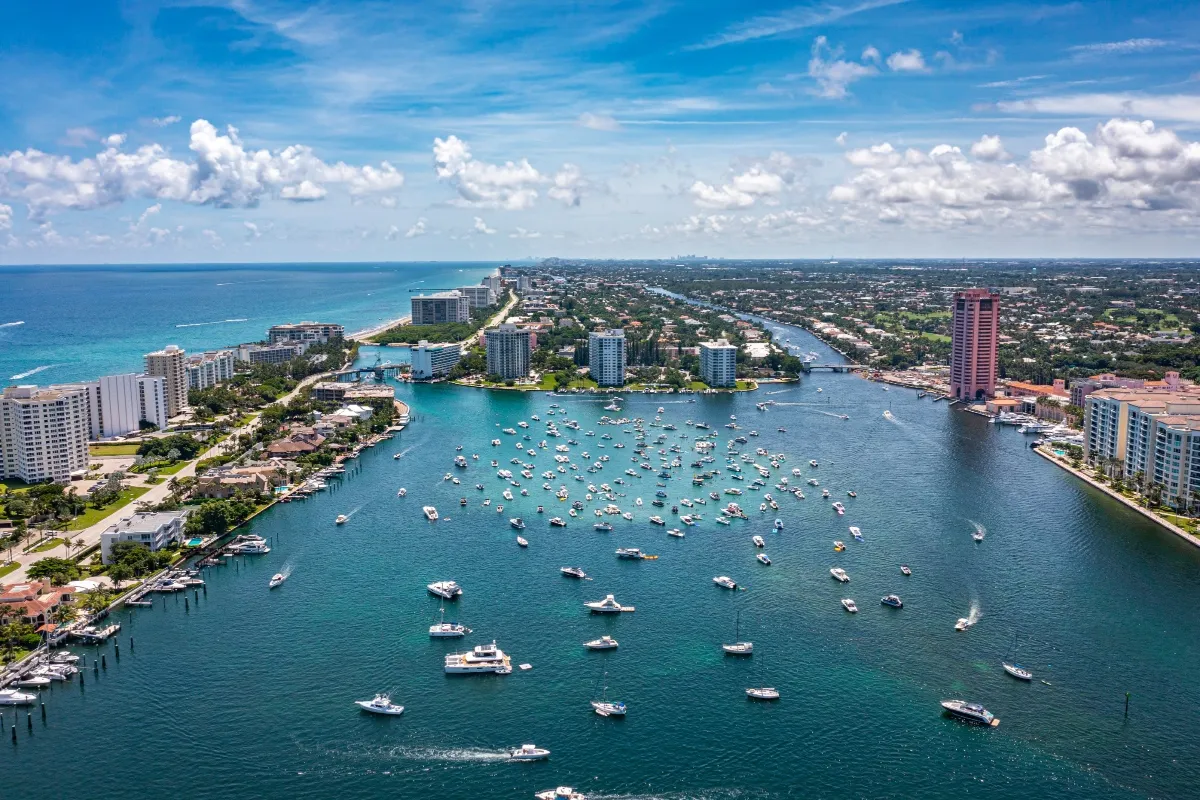
Planning, buying, insuring, or managing coastal property in Southeast Florida means answering two related questions: (1) Is the property in a FEMA flood zone (and what’s the Base Flood Elevation)? and (2) How exposed is it to storm surge? The places in this short guide differ in how those questions are answered: Boca Raton and Deerfield Beach include barrier-island / Intracoastal neighborhoods where ocean surge and wave action are key risks, while Palm Coast’s risk picture is shaped by the Intracoastal Waterway plus many freshwater and saltwater residential canals. Below is a practical, repeatable checklist and what to watch for in each area.
Boca Raton / Deerfield Beach: barrier islands + Intracoastal — higher direct storm-surge and wave action risk; updated county FIRMs are especially important.
Living on Florida’s barrier islands and along the Intracoastal Waterway brings exceptional waterfront lifestyle benefits — beaches, boating access, and scenic views — but it also concentrates exposure to coastal hazards. In Boca Raton (Palm Beach County) and Deerfield Beach (Broward County), properties on the barrier island strip and the adjacent Intracoastal shorelines face higher direct storm-surge and wave-action risk than inland properties. That elevated coastal risk makes it especially important to check the county and FEMA Flood Insurance Rate Maps (FIRMs), confirm building elevations, and carry appropriate insurance.
Why barrier islands and Intracoastal shores are higher risk
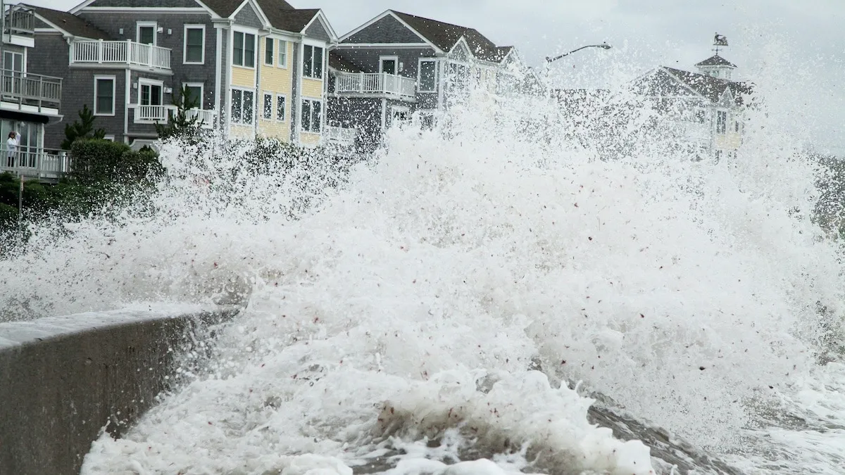
Direct surge pathway. Barrier islands sit between the Atlantic and the mainland; storm surge — the storm-driven rise in water level — hits those islands first and can push large volumes of water across beaches and into Intracoastal canals and waterways. That surge is often accompanied by wave action that can damage foundations, bulkheads, and first-floor living spaces.
Amplified wave action at structures. Even when surge levels are similar to nearby inland zones, structures directly exposed to open water face wave forces that inland buildings (or those behind natural dunes and wider buffers) do not. Those waves cause impacts classified in FIRMs as areas subject to wave run-up and “Limit of Moderate Wave Action” (LiMWA).
Canal connectivity. The Intracoastal and connecting canals create conduits for surge to reach otherwise protected parcels — so an Intracoastal-front home can see combined surge from the ocean and from widened channels. Municipal flood pages and climate-risk tools for both Boca Raton and Deerfield Beach call out canals and waterways as common flood hazards.
The role of updated FIRMs — don’t rely on old maps
FEMA’s FIRMs and each county’s implementation matter because they set regulatory flood zones, building/elevation requirements, and the basis for flood insurance rates. Both Palm Beach and Broward counties completed major FIRM updates in recent years — maps that changed who is shown as living inside higher-risk Special Flood Hazard Areas (SFHAs). These new maps are already being used by local building divisions and insurers to determine permitting and policy pricing, so checking the current county FIRM is essential before buying, renovating, or underwriting a property.
Step-by-step: how to check surge/flood risk for a property in Boca Raton / Deerfield Beach
Start with the city/county flood pages. City portals (e.g., Boca Raton’s “Know Your Floodzone” and Deerfield Beach’s flood information page) provide local guidance, links to the county maps, and contact points for floodplain staff. Use them to find local requirements for Elevation Certificates and permits.
Search the FEMA Flood Map Service Center (MSC). Enter the property address on FEMA’s MSC to pull the official FIRM panel, floodway info, and any Letters of Map Change (LOMCs). The MSC is the authoritative source for NFIP map products.
Check county interactive flood/map viewers. Palm Beach and Broward maintain interactive viewers that overlay LiMWA (wave action limits), building footprints, and the latest SFHA boundaries — useful for seeing how close a site is to the Intracoastal, canals, or barrier-island shoreline. These viewers often incorporate the most recent FIRM revisions and notes about effective dates.
Confirm building elevation & certificates. If the map shows SFHA or LiMWA exposure, ask the seller or local permitting office for an Elevation Certificate (EC). The EC shows a building’s finished-floor elevation relative to the Base Flood Elevation (BFE) and is required by insurers and for permitting in many cases.
Ask about Letters of Map Amendment/Revision. Property-specific changes (LOMA/LOMR) can alter regulatory flood status; confirm whether any exist for the parcel via FEMA/ county records.
Get a professional determination for purchases/renovations. For transactions or structural work, obtain a certified floodplain determination from a Florida-licensed surveyor, engineer, or the local floodplain manager. County sites remind users that online maps are a starting point — final determinations may require surveys.
Insurance, building, and mitigation actions
Buy flood insurance proactively. Even if a property currently sits just outside an SFHA, barrier/island locations can be quickly reclassified during storm-driven changes — and many lenders require insurance if a property is mapped into an SFHA. Use the FIRM and EC to shop for NFIP or private flood quotes.
Design for wave action where applicable. Where FIRMs show LiMWA or V-zones, design standards require elevated, flood-resistant construction and often specific foundation systems (pilings, open foundations) to let water and waves pass without catastrophic structural damage. Check county building codes and permit requirements.
Harden and plan. For Intracoastal/canal properties, inspect seawalls and bulkheads, document maintenance history, and consider elevation of utilities and first-floor living areas. Create an evacuation and property-shutoff plan before hurricane season. Local city pages list common mitigation tips and emergency contacts.
If you own, insure, or are considering buying waterfront or Intracoastal property in Boca Raton or Deerfield Beach, treat the FIRMs as living documents: check the county/FEMA map viewers and the city flood pages now and whenever you prepare to buy, rebuild, or set insurance. The combination of direct ocean exposure, canal connections, and wave action can mean higher damage potential and different building practices than inland properties — and recent FIRM updates in both Palm Beach and Broward counties have changed regulatory risk for many coastal parcels.
Palm Coast: ICW + many canals — surge risk exists but canal depth, local seawalls, and canal maintenance/dredging affect exposure and flooding behavior. Check Flagler County / City of Palm Coast canal studies and local FIRMs.
Palm Coast’s waterfront is defined less by long oceanfront barrier islands than by a web of saltwater canals, the Intracoastal Waterway (ICW), and direct connections to the Atlantic. That configuration means storm surge can reach neighborhoods that are not immediately oceanfront — but how much and how fast depends heavily on local canal geometry, seawalls, and whether canals are dredged and maintained. If you live, insure, or are considering buying a canal-front property in Palm Coast, treating the canals themselves as part of your flood-risk picture is essential.
How canals change surge and flood behavior
Canal depth and cross-section control capacity. Deeper, wider canals can move larger volumes of water away from the ocean or absorb surge more readily; shallow or silted canals reduce that capacity and can cause water to back up into neighborhoods. Palm Coast’s original canal construction depths (often deeper in the 1960s–1970s) have been reduced in many places by sedimentation, which influences how surge propagates into inland areas.
Seawalls and bulkheads change local hydraulics. A continuous seawall may protect a single lot from direct beach erosion but can transfer wave energy and reduce natural floodplain storage — in some cases contributing to higher water levels on the inland side during extreme events. The presence, condition, and height of seawalls along canals therefore matter when estimating surge impacts.
Canal connections create surge pathways. The ICW and entrance canals form conduits; during a storm they can carry elevated tidal and surge water inland where there’s less natural buffering (marshes, dunes). Compound flooding — where surge and heavy rainfall occur together — can amplify the effect in low-lying canal neighborhoods. Recent Flagler County vulnerability work explicitly highlights compound flood scenarios.
Why maintenance and dredging matter
Dredging restores capacity and navigation, and can reduce local flooding risk. The City of Palm Coast has been evaluating saltwater canal dredging and maintenance programs (including drone surveys and canal studies) to identify where sediment has reduced depths and to estimate costs and priorities for restoring design depths. Restoring original depths increases the ability of canals to convey water, improves boat access, and can reduce localized ponding.
Maintenance frequency is a performance driver. Regular clearing of debris, vegetation trimming, and removal of sediment are operational measures that keep canal flow paths functioning. Palm Coast publishes canal maintenance standards and updates on priority dredging projects (for example Pine Grove and other stretches). Knowing a canal’s maintenance schedule helps predict short-term exposure versus long-term risk.
Practical, step-by-step checks for property owners and buyers
Pull the local FIRM and city flood resources. Start with the City of Palm Coast’s FIRM index page and Flagler County flood-zone resources to find the official flood zone and base flood elevations for an address. FIRMs remain the regulatory baseline for NFIP insurance and building requirements.
Review the Palm Coast saltwater canal study and dredging reports. Read the city’s saltwater canal study summaries, drone-survey notices, and council presentations to learn which canals have been surveyed, their current condition, and planned dredging phases. These reports often include maps, cross-sections, and recommendations that directly affect surge pathways.
Check recent Flagler County vulnerability / compound-flood assessments. County-level vulnerability analyses and compound-flood modeling show where surge + rainfall interactions worsen outcomes — information that can differ from single-event FIRM panels. Use these to understand neighborhood-scale risk beyond the FIRM’s regulatory footprint.
Ask about canal depth, seawall condition, and maintenance history. For a specific parcel, request recent canal bathymetry (depth) data or the city’s survey results, seawall inspection or repair records, and the city’s maintenance/dredging schedule for that canal. These operational details materially influence short- and medium-term exposure.
Confirm elevation and LOMC/EC documents. Obtain an Elevation Certificate (EC) for the building and search FEMA records for any Letters of Map Change (LOMA/LOMR) that alter a property’s regulatory flood status. Even canal-side properties just outside SFHAs can be vulnerable in compound events.
Consider professional hydrologic/hydraulic review for large projects. If you plan major renovations, bulkhead work, or development, a licensed engineer can model how proposed changes (raised seawalls, regrading, new connections) will affect local hydraulics during surge and compound flooding events. County and city permitting may require this for substantial work.
Insurance, mitigation, and preparedness tips
Buy flood insurance even if not in an SFHA. Canals and ICW connections can create localized exposures that standard maps miss — and insurance is the most reliable way to transfer financial risk from an unexpected mapping change or compound flooding event. Use FIRM panels and ECs to get accurate quotes.
Maintain seawalls and document work. Well-documented seawall repairs and elevations matter for insurance underwriting and post-storm claims. Consider elevating utilities and flood-proofing ground-level spaces where practical.
Stay informed about canal projects. City council updates, public surveys, and project pages typically explain timelines and community impacts for dredging — projects that can take years to plan and fund but will change local risk profiles when completed.
Palm Coast’s canal network and ICW give neighborhoods waterfront character — but they also create pathways for storm surge and compound flooding that depend strongly on canal depth, seawall condition, and active maintenance programs. To understand and manage risk, combine the regulatory baseline (FIRMs and Elevation Certificates) with the operational reality (canal surveys, dredging plans, seawall records) and recent county vulnerability work. That combined view will give you the clearest, most practical picture of surge exposure for any given canal-front property.
Step-by-step flood-zone & storm-surge check
Step 1: Start with FEMA’s Flood Map Service Center — Search the Property Address
Before you evaluate any property’s flood risk, the most reliable and official place to begin is FEMA’s Flood Map Service Center (MSC). This online tool provides the official record of U.S. flood zones and Flood Insurance Rate Map (FIRM) panels used by insurers, lenders, and local governments.
Understanding a property’s FEMA flood zone is essential for decisions about insurance coverage, construction requirements, and overall risk awareness — especially in coastal and low-lying areas like South Florida or canal-front neighborhoods.
Why the FEMA Flood Map Service Center matters
The MSC is FEMA’s authoritative database for all flood hazard mapping under the National Flood Insurance Program (NFIP). Each property is assigned to a specific FIRM panel, which identifies its flood zone designation — such as:
Zone V or VE: Coastal areas with high risk of storm surge and wave action.
Zone A or AE: Inland high-risk flood zones, typically near rivers, canals, or lakes.
Zone X: Moderate- to low-risk areas (still subject to some flooding).
Lenders, insurance agents, and building departments rely on these FIRM panels to determine whether flood insurance is required and what construction elevations or permits apply. Because local maps can be updated or revised, checking directly with FEMA ensures you’re looking at the most current official version.
How to check your property on FEMA MSC
Go tomsc.fema.gov.
Enter the property address in the search bar.
Review the search results, which will display the property’s flood zone, panel number, and map effective date.
Open the interactive map to see the property’s exact location relative to flood boundaries.
Download a “FIRMette” — a small, printable section of the official map showing your property and its flood zone designation. This FIRMette serves as documentation for insurance applications, lender reviews, or local permitting.
💡 Tip: Keep a copy of the downloaded FIRMette (PDF or printed) for your property records. It provides the official FEMA reference for your parcel’s flood designation and can help you compare with any county or city flood map updates.
What to do next
Once you’ve confirmed the zone and FIRM panel, take the next step by checking your county or city flood resources (for example, Palm Beach, Broward, or Flagler County map viewers). Local agencies often layer FEMA data with LiMWA (Limit of Moderate Wave Action) lines, elevation data, and recent amendments (LOMAs/LOMRs) for more refined local analysis.
Combining the FEMA base map with your local flood tools gives you the most accurate picture of both federal and local flood risk — critical for buying, building, or insuring coastal or canal-front property.
Step 2: Pull the County or City GIS Flood Viewer and FIRM Panels for Local Context
After confirming a property’s flood zone through FEMA’s Flood Map Service Center (MSC), the next essential step is to review the county or city’s GIS flood viewer. These local platforms provide enhanced, interactive flood maps that integrate FEMA’s official data with local updates, infrastructure information, and site-specific refinements.
While FEMA’s FIRM panels are the federal baseline, local GIS viewers add real-world context — including recent map revisions, seawall inventories, canal systems, and Letters of Map Amendment (LOMAs) or Revision (LOMRs) that may not yet appear on the national map.
Why local GIS flood viewers matter
County and municipal floodplain management offices often maintain interactive GIS maps that build upon FEMA’s official FIRM data. These local layers are critical because they:
Reflect recent flood-zone updates or remapping projects pending FEMA adoption.
Include seawalls, drainage basins, canals, and infrastructure that affect local flood behavior.
Display Elevation Certificates (ECs), historic flooding areas, or model results from vulnerability assessments.
Provide public notices of preliminary FIRM changes, helping residents anticipate future adjustments to insurance or permitting requirements.
By reviewing both FEMA’s MSC and your county’s GIS viewer, you can see how national flood boundaries align with local topography, infrastructure, and active mitigation projects.
How to use your county or city GIS flood viewer
Locate your local flood viewer or map portal.
Palm Beach County: Offers an Interactive Flood Zone Map and updates about FEMA’s 2024 FIRM changes.
Broward County: Publishes a Flood Zone Map Viewer with links to FEMA updates and coastal resilience planning.
Flagler County / City of Palm Coast: Host detailed FIRM panels, canal maps, and recent saltwater canal studies showing depth, seawall data, and maintenance updates.
Search by property address to view your parcel’s flood zone, base flood elevation, and adjacent water features.
Turn on map layers such as LiMWA (Limit of Moderate Wave Action), recent Letters of Map Amendment (LOMA/LOMR), or local drainage improvements.
Compare against FEMA’s FIRM panel. Local viewers may show updated flood boundaries not yet reflected on FEMA’s national map, offering a clearer picture of current local risk.
Save screenshots or map exports for your records — useful when discussing coverage or floodplain compliance with your insurer or building department.
💡 Tip: Always check the “effective date” of your county or city map. Some maps show preliminary or pending FIRMs — meaning your current insurance or permit requirements may still follow the effective FEMA version until official adoption.
Why comparison is critical
Flood risk management is a partnership between federal and local authorities. FEMA provides standardized mapping through FIRMs, while counties and cities supply on-the-ground accuracy — including recent infrastructure upgrades, localized drainage models, and coastal adaptation projects.
Comparing the two ensures you don’t miss:
Recent reclassifications that could change flood-insurance requirements.
Canal or seawall maintenance projects affecting water flow and flood potential.
Preliminary FIRMs or amendments that might shift your property’s flood zone in the near future.
Florida Coastal Counties: Local Flood Map Resources You Should Know
Florida’s coastal counties each maintain their own flood zone determination tools and interactive map viewers that complement FEMA’s national Flood Insurance Rate Maps (FIRMs). These county and city resources provide localized, real-time context — showing how flood zones intersect with local infrastructure, seawalls, canals, and planned resilience projects.
Whether you own property in Palm Beach County, Broward County, or Flagler County / City of Palm Coast, reviewing both FEMA’s official FIRMs and your local flood-mapping platforms ensures you have the clearest, most accurate picture of your property’s flood exposure.
Palm Beach County — Flood Zone Determination & Interactive Flood Map
Palm Beach County’s Division of Emergency Management operates an interactive flood map that allows property owners to check flood zones, view FEMA’s latest map revisions, and explore county-specific floodplain data.
The platform integrates FEMA FIRMs with local topography and infrastructure information to support:
Flood insurance determinations for homeowners and lenders
Elevation and base flood elevation (BFE) details for builders and surveyors
Awareness of pending FEMA map updates, such as the 2024 FIRM effective date
Residents can search their address, print a map, or contact the county’s floodplain management office for official documentation.
🔗 Palm Beach County Flood Map Resource:https://discover.pbcgov.org/publicsafety/dem/Pages/Flood-Zones.aspx
Broward County — Flood Zone Map & FEMA FIRM Updates
Broward County’s Resilience Division maintains a robust Flood Zone Map Viewer that combines FEMA’s FIRMs with county-level data on sea-level rise, drainage basins, and coastal infrastructure. The site also highlights FEMA’s July 31, 2024 FIRM update, helping property owners see whether their flood designations have changed.
The viewer offers:
Address-based flood zone lookups
Links to FEMA’s Flood Map Service Center
County notices about preliminary and effective FIRM adoption
Educational resources on flood mitigation and insurance
This resource is particularly valuable for coastal and Intracoastal properties, where storm surge and tidal flooding risks can vary across short distances.
🔗 Broward County Resilience / Flood Map Viewer:https://www.broward.org/resilience
Flagler County — Flood Zone Information & Map Resources
Flagler County’s Growth Management Department provides flood zone resources tailored to residents of Palm Coast, Flagler Beach, and unincorporated areas. The county’s interactive map viewer overlays FEMA’s FIRMs with LiDAR-based elevation, local drainage features, and vulnerability assessment data developed through regional resilience programs.
The site helps users:
Find their official flood zone and panel number
Review letters of map change (LOMA/LOMR) affecting their property
Access the county’s coastal vulnerability and compound flooding studies
Flagler County encourages property owners to contact local floodplain staff for site-specific assistance or to verify FEMA data before construction or purchase.
🔗 Flagler County Flood Map Resource:https://www.flaglercounty.gov
City of Palm Coast — FIRM and Canal Map Resources
The City of Palm Coast supplements Flagler County’s maps with FIRM panels, canal maps, and floodplain studies specific to the city’s extensive canal system and Intracoastal frontage. The city’s flood information portal provides:
FEMA FIRM panels with effective and preliminary zones
Saltwater canal studies and dredging project data
Links to Elevation Certificate requests, floodplain permits, and NFIP resources
Palm Coast’s mapping and engineering divisions use these datasets to evaluate surge behavior, canal maintenance impacts, and compliance with flood-resistant construction standards.
🔗 City of Palm Coast Flood & Canal Map Resource:https://www.palmcoast.gov
Why These Local Resources Matter
While FEMA’s Flood Map Service Center is the official national source, county and city viewers incorporate up-to-date local conditions — including recent re-maps, seawall maintenance, drainage projects, and canal system data. Reviewing both ensures:
A more accurate risk assessment for insurance and investment decisions
Awareness of upcoming map changes that could alter flood insurance requirements
Access to local floodplain staff who can clarify building or permitting rules
In Florida’s dynamic coastal environment, combining federal FIRMs with local GIS flood maps gives residents the most reliable understanding of their true flood exposure.
Step 4: Run a Storm-Surge Check with NOAA / NHC Storm-Surge Maps
Understanding flood risk requires more than reviewing FEMA’s Flood Insurance Rate Maps (FIRMs). While FIRMs show the 1% annual chance flood (the “100-year flood”), they are primarily based on riverine, tidal, and historical storm modeling. Storm surge hazard, on the other hand, represents how far and how deep water can push inland during hurricanes — a critical risk for coastal and Intracoastal properties. For this, NOAA and the National Hurricane Center (NHC) provide dedicated storm-surge resources.
Why storm-surge maps are essential
Storm surge risk differs from standard FEMA flood zones in several key ways:
Near-worst-case scenarios: NHC storm-surge maps model Category 1–5 hurricane scenarios and show the maximum expected inundation along the coast.
Pathways into canals and ICW: Surge doesn’t stop at the shoreline. It moves inland through Intracoastal waterways, canals, and low-lying streets, creating flood hazards even for properties outside FEMA-designated SFHAs.
Planning and mitigation: Homeowners, planners, and insurers can visualize potential surge depth, identify evacuation routes, and make informed decisions about flood-proofing or insurance coverage.
These maps complement FEMA FIRMs, providing a dynamic, scenario-based view of hurricane-driven flooding that static 100-year flood maps cannot fully capture.
How to use NOAA / NHC storm-surge maps
Access NOAA’s National Storm Surge Risk Maps:
Visit NOAA’s Office for Coastal Management or the National Hurricane Center (NHC) online portal.
These maps show maximum surge inundation for every county along the Atlantic and Gulf coasts.
Explore SLOSH (Sea, Lake, and Overland Surges from Hurricanes) outputs:
The SLOSH model simulates storm surge heights based on hurricane intensity, track, forward speed, and land topography.
Use SLOSH output maps to see potential surge paths into canals, rivers, and the Intracoastal Waterway.
Compare surge footprints to property locations:
Overlay NOAA/NHC maps with FEMA FIRM panels and local GIS layers.
Identify critical surge pathways, areas at risk of compound flooding, and neighborhoods that could experience both surge and rainfall-driven flooding.
Scenario planning:
Use storm-surge maps for emergency preparedness, evacuation planning, and risk mitigation strategies.
They are also helpful for insurance discussions, highlighting why flood coverage may be necessary even outside high-risk FEMA zones.

Step 5: Extra Checks for Barrier-Island / Intracoastal Properties — Boca Raton & Deerfield Beach
Owning or buying a property on Florida’s barrier islands or Intracoastal shorelines — such as Boca Raton and Deerfield Beach — requires additional flood-risk due diligence. These locations face not just standard flooding but also wave action, direct storm surge, and complex water-flow dynamics influenced by inlets, bridges, and canals.
1. Wave Action and V-Zone Status
Barrier islands often fall into V or VE flood zones on FEMA FIRMs. These designations indicate areas at high risk from storm surge and breaking waves. Properties in these zones are subject to:
Elevated foundation requirements (open foundations, pilings, or columns)
Vortex-resistant designs to reduce structural damage from high-velocity water and wave impact
Higher insurance premiums due to direct exposure to ocean waves
If a home faces the ocean directly, anticipate both storm surge and wave run-up concerns, not just traditional 100-year flood risk. The First Street Foundation Flood Factor tool can help visualize potential wave and surge impacts for a specific property.
🔗 Flood risk tool:https://help.firststreet.org
2. Bridge Openings, Inlets, and Channels
Storm surge doesn’t stop at the shoreline — it is often funneled inland through bridges, inlets, and Intracoastal connections. For Boca Raton and Deerfield Beach:
Boca Inlet and Hillsboro Inlet are key pathways for surge to reach Intracoastal neighborhoods.
Bridge openings and channel depths influence the speed and height of surge inland.
Reviewing historical inlet behavior can reveal which areas experience recurrent flooding during tropical storms.
Local city and county engineering departments often maintain inlet and canal maps showing water-flow patterns during storms.
3. Recent Map Updates
Southeastern Florida has undergone extensive FIRM remapping in the last several years, impacting both flood insurance and permitting requirements:
Flood-zone & storm-surge checks: step-by-step for Boca/Deerfield (barrier island/Intracoastal) vs. Palm Coast (ICW + freshwater canals)County and Broward County post updates on effective dates for newly revised FIRMs.
Even minor panel changes can shift a property from moderate- to high-risk designation, affecting insurance premiums and required building elevations.
Always check current county portals in addition to FEMA MSC maps to ensure you have the latest official data before purchasing, building, or applying for permits.
Barrier-island and Intracoastal properties combine the benefits of oceanfront or waterfront living with elevated storm-surge and wave hazards. To manage these risks:
Confirm V/VE flood zone status and associated building requirements.
Evaluate storm surge pathways via inlets, bridges, and channels.
Review recent county FIRM updates for regulatory changes affecting insurance and permits.
This due diligence is critical for both property safety and financial planning in hurricane-prone Florida.
Step 6: Canal-Specific Checks for Palm Coast Properties (ICW + Canals)
Palm Coast’s extensive Intracoastal Waterway (ICW) and canal network gives residents waterfront access and scenic views, but it also introduces unique flooding dynamics. Storm surge and tidal flows can travel through canals, and local conditions like canal depth, seawall status, and dredging significantly influence how water impacts properties.
1. Canal Salinity, Seawalls, and Dredging Status
Flooding behavior in Palm Coast canals is affected by:
Canal elevation and tidal connectivity: Canals directly connected to the ICW or ocean can transmit surge or tidal flows inland.
Seawall condition: Aging or compromised seawalls reduce protective capacity and can allow water to inundate adjacent lots.
Silted or shallow canals: Sedimentation reduces canal capacity, causing higher water levels during storms and impeding drainage.
Palm Coast city reports and studies on canal maintenance and dredging provide insight into ongoing risk management and highlight areas where funding gaps or maintenance delays could elevate flood risk.
2. Saltwater Intrusion and Backflow Paths
Even inland canals can experience surge-driven backflow if they connect to the ICW or ocean via channels, locks, or culverts. The shape, width, and depth of these canals directly influence how far surge or elevated tides can propagate inland.
Monitoring saltwater intrusion is also critical: rising salinity can affect bulkhead materials, landscaping, and freshwater availability, and signal potential surge pathways during extreme storms.
3. Practical Steps for Property Owners
Check city canal reports and dredging schedules: Palm Coast provides documentation on recent canal dredging, maintenance plans, and condition surveys.
Compare to FEMA and local FIRM maps: Overlay canal locations with flood zones to assess potential surge or backflow exposure.
Review tidal and salinity data: Tools like NOAA tidal gauges or climate-data portals can help gauge surge propagation risk.
Incorporate into insurance and building decisions: Properties adjacent to poorly maintained or shallow canals may require higher flood insurance coverage or additional mitigation measures.
💡 Tip: Use interactive tools like the Climate Resilience Toolkit to visualize flood risk and canal surge pathways, particularly for compound flooding scenarios.
Step 7: Check for Elevation Certificates, LOMA/LOMR, and Local Building Codes
When evaluating flood risk for a property, especially in coastal or canal-front areas, it is critical to review Elevation Certificates (ECs), Letters of Map Amendment (LOMA/LOMR), and local building codes. These documents and regulations provide precise, site-specific information that can affect insurance, permitting, and construction requirements.
1. Elevation Certificate (EC)
An Elevation Certificate is an official survey showing the finished floor elevation (FFE) of a building relative to the Base Flood Elevation (BFE). Key uses include:
Determining flood insurance premiums for NFIP policies.
Supporting LOMA or LOMR requests to amend FEMA’s mapped flood zone designation.
Guiding building modifications or flood-proofing upgrades to comply with local and federal standards.
Property buyers or insurers should request the most recent EC from the seller, surveyor, or local permitting office.
2. LOMA / LOMR
A Letter of Map Amendment (LOMA) is issued by FEMA when a property is determined to be above the BFE, effectively removing it from a Special Flood Hazard Area (SFHA) on the FIRM. A Letter of Map Revision (LOMR) can amend the flood map for other reasons, such as structural changes or updated topography.
LOMA process: Homeowners submit elevation data (typically via an EC) to FEMA to request a review of their flood zone designation.
Benefits: Successful LOMA or LOMR requests can reduce or eliminate the requirement for mandatory flood insurance, although optional coverage may still be advisable.
Local guidance: Cities like Deerfield Beach provide clear LOMA procedures and contact points for residents considering this process.
🔗 Deerfield Beach LOMA guidance:https://www.deerfield-beach.com
3. Local Building Codes
Local building codes often require flood-resistant construction measures, especially for:
V/VE coastal zones
Canal-front or Intracoastal properties
Structures undergoing major renovations or new construction
These codes specify minimum elevations, foundation types, flood vents, and material standards, and they work in conjunction with FEMA FIRMs and EC/LOMA documentation. Checking building codes ensures compliance and can prevent costly post-construction corrections.
For property owners, buyers, or insurers, verifying Elevation Certificates, LOMA/LOMR status, and applicable local building codes is essential to:
Accurately assess flood risk and insurance needs
Confirm regulatory compliance
Plan for resilient construction or retrofitting
This step is especially important in high-risk barrier-island, Intracoastal, or canal-front neighborhoods, where elevation and local codes significantly influence storm-surge and wave-action protection.

Step 8: Insurance and Financing Consequences — Run a Sample Insurance Quote
Understanding a property’s flood insurance requirements and costs is a critical step when buying or owning coastal or canal-front real estate. This is especially true for areas like Boca Raton, Deerfield Beach, and Palm Coast, where flood zones, storm surge, and elevation can vary significantly from street to street.
1. Flood Insurance Requirements
Properties located in Special Flood Hazard Areas (SFHAs) — FEMA-designated Zone A, AE, or V/VE — are subject to mandatory flood insurance requirements if financed through federally regulated lenders. Key points include:
Insurance is mandatory in SFHAs for most mortgages; failure to maintain coverage can trigger lender penalties.
Zone designation matters: Coastal V/VE zones (barrier islands) usually carry higher premiums than AE or A zones (inland or ICW-adjacent areas).
Elevation impacts pricing: Properties above the Base Flood Elevation (BFE) can qualify for reduced premiums, whereas those below BFE may face increased rates.
Even properties outside SFHAs (Zone X) may benefit from optional flood insurance due to storm surge risk, canal backflow, or compound flooding scenarios.
2. Running a Sample Insurance Quote
To get a realistic estimate of flood insurance costs:
Use a local independent insurance agent who understands Boca Raton/Deerfield Beach or Palm Coast flood risks. Local knowledge ensures proper evaluation of:
NFIP (National Flood Insurance Program) policies
Private flood insurance alternatives
V/VE or AE zone-specific considerations
Provide flood zone and elevation data: Insurance companies use FEMA FIRM panels, local county maps, and Elevation Certificates (ECs) to calculate risk and premiums.
Compare NFIP vs. private options: Private carriers may offer lower premiums, higher coverage limits, or more flexible terms for certain properties, especially in high-risk zones.
Running a sample quote before purchasing a property helps avoid surprises at closing, ensures compliance with lender requirements, and aids in financial planning for ongoing premiums.
3. Why Local Knowledge Matters
Flood risk in Florida is highly localized:
In Boca Raton and Deerfield Beach, barrier islands and oceanfront homes face V-zone and wave-action risks.
In Palm Coast, canal-connected properties have surge and backflow concerns that may not be obvious from FEMA FIRMs alone.
A local agent can interpret maps from:
FEMA MSC (https://msc.fema.gov)
County GIS viewers
City or county canal/flood reports
This ensures your insurance coverage aligns with actual risk, not just the broad flood zone designation.

Step 9: Historical Storm and Local Notice Checks
Flood-risk evaluation isn’t just about maps and models — historical storm data and local notices provide critical real-world context. By reviewing past events, homeowners, buyers, and insurers can see how water behaves in a specific neighborhood and identify vulnerabilities that static FEMA FIRMs or county GIS maps may not capture.
1. Why Historical Storm Data Matters
FEMA and local flood maps show predicted or modeled flood risks, but actual past events reveal practical exposure, including:
Inlet overwash or beach breach events along barrier islands
Canal or ICW overtopping in low-lying inland neighborhoods
Localized ponding after heavy rainfall or storm surge
Infrastructure impacts, such as flooded streets, damaged seawalls, or compromised bridges
Historical data helps you assess whether a property has repeatedly experienced flooding, even if it’s not currently mapped as high-risk.
2. Sources for Historical and Local Notices
To gather practical historical storm information:
Local municipal or county emergency management pages:
Often include post-storm damage reports, emergency response logs, and evacuation zone maps.
Provide information on ongoing resilience projects and planned flood mitigation.
Local news archives:
Newspapers and online news outlets frequently report on past hurricanes, tropical storms, and flooding events, noting neighborhoods most affected.
Search for terms like “storm surge Boca Raton,” “Deerfield Beach canal flooding,” or “Palm Coast hurricane impacts.”
Neighborhood or community records:
HOAs or local homeowner associations may maintain internal storm logs, providing property-specific context not captured in county-level reports.
💡 Tip: Combining historical accounts with FEMA/FIRM data and local GIS layers gives a more complete flood-risk profile for decision-making.
3. Practical Applications
Insurance planning: Historical evidence of flooding can influence policy limits and premiums.
Emergency preparedness: Knowing previous surge pathways and canal overtopping points aids in evacuation and mitigation planning.
Property assessment: Helps buyers and investors understand true exposure and potential mitigation needs.
Step 10: Practical Flood Mitigation Steps for Property Owners and Managers
Owning or managing a coastal or canal-front property in Florida comes with unique flood risks, from storm surge on barrier islands to backflow in canals. Implementing practical mitigation measures can protect both the property and your investment, reduce insurance costs, and improve resilience during hurricanes or heavy rainfall.
1. Elevate Finished Floors Above BFE
Finished-floor elevation (FFE) above the Base Flood Elevation (BFE) is one of the most effective ways to reduce flood damage.
Certified contractors should perform elevation work to comply with FEMA, NFIP, and local building codes.
Elevation improvements may also qualify the property for lower flood insurance premiums or support LOMA/LOMR requests.
2. Flood-Resistant Materials and Floodproofing
For first floors, use materials designed to withstand water exposure (concrete, pressure-treated wood, or marine-grade finishes).
Decide between dry floodproofing (sealing the building against water intrusion) and wet floodproofing (allowing water to enter certain areas while protecting structural elements).
Note: Wet floodproofing is generally prohibited for residential buildings under NFIP regulations in most V or A zones, so consult your insurer and local building codes before planning.
3. Maintain Seawalls, Bulkheads, and Canals
Regular inspection and maintenance of seawalls and bulkheads are essential to protect against surge and wave erosion.
Understand responsibilities for upkeep:
Property owner
Homeowners’ association (HOA)
Municipality or city (especially for canals)
Palm Coast city reports provide detailed guidance on canal maintenance schedules, dredging responsibilities, and associated costs, which influence both flooding risk and insurance considerations.
4. Additional Mitigation Practices
Clear debris from drains and culverts near the property to improve local drainage.
Install backflow preventers for sewer and stormwater systems to reduce interior flooding.
Maintain emergency supplies and an evacuation plan tailored to your property’s flood risk and local zone designation.
💡 Tip: Combining elevation, flood-resistant materials, and infrastructure maintenance provides a layered approach that significantly reduces property damage during hurricanes or storm events.
Quick comparison checklist: Boca/Deerfield vs Palm Coast
Primary hazard driver
Boca/Deerfield: ocean surge + wave action → direct coastal surge and V-zone concerns.
Palm Coast: ICW + canals → surge propagates through ICW and canals; canal depth and seawall condition matter more.
Most important maps to check
Both: FEMA Flood Map Service Center (FIRMs).
Boca/Deerfield: county interactive flood viewers + NHC storm surge maps.
Palm Coast: City of Palm Coast / Flagler County FIRM panels + local canal studies/dredging reports.
Typical mitigation focus
Boca/Deerfield: structural elevation, breakaway walls, engineered foundations, coastal erosion controls.
Palm Coast: seawall maintenance, canal dredging plans, pump/drainage capacity, community funding mechanisms for canal maintenance.
Sources
City of Boca Raton — Know Your Floodzone. myboca.us
City of Deerfield Beach — Flood Information. deerfield-beach.com
Palm Beach County — Update on Flood Zones (FEMA map changes effective Dec 20, 2024). discover.pbc.gov
Broward County — FEMA FIRM updates effective July 31, 2024 (county flood map resources). broward.org
FEMA Flood Map Service Center (MSC) — official FIRM search and products. msc.fema.gov
City of Palm Coast — Results of Palm Coast Saltwater Canal Study / canal project pages. palmcoast.gov+1
Palm Coast — Flood Insurance Rate Maps (FIRM) index and city FIRM resources. palmcoast.gov
Palm Coast — Canal maintenance and dredging updates (Canals / Canal Maintenance pages). palmcoast.gov+1
Local reporting on canal dredging, costs, and council actions (Palm Coast Observer / local media). Observer Local News+1
Flagler County — Flood Zone Information & county vulnerability/compound-flood assessments. flaglercounty.gov+1
FEMA — Flood Map Service Center (official FIRMs and LOMA/LOMR searches). msc.fema.gov+1
Federal Emergency Management Agency (FEMA). Flood Map Service Center (MSC): Search by Address.https://msc.fema.gov
FEMA — Understanding Flood Maps and Flood Zones. (NFIP Resources)
Palm Beach County — Flood Zone Determination & Interactive Flood Map.https://discover.pbcgov.org/publicsafety/dem/Pages/Flood-Zones.aspx
Broward County — Flood Zone Map & FEMA FIRM Updates.https://www.broward.org/resilience
Flagler County — Flood Zone Information & Map Resources.https://www.flaglercounty.gov
City of Palm Coast — FIRM and Canal Map Resources.https://www.palmcoast.gov
Palm Beach County — Flood Zone Determination & Interactive Flood Map.https://discover.pbcgov.org/publicsafety/dem/Pages/Flood-Zones.aspx
Broward County — Flood Zone Map & FEMA FIRM Updates.https://www.broward.org/resilience
Flagler County — Flood Zone Information & Map Resources.https://www.flaglercounty.gov
City of Palm Coast — FIRM and Canal Map Resources.https://www.palmcoast.gov
NOAA — National Storm Surge Risk Maps.https://coast.noaa.gov/stressors/storm-surge.html
National Hurricane Center (NHC) — Storm Surge and SLOSH Modeling.https://www.nhc.noaa.gov/surge/
FEMA — Understanding the Difference Between 100-Year Floods and Storm Surge Hazards.https://www.fema.gov/flood-maps
First Street Foundation — Flood Factor / Hurricane and Wave Risk Tool.https://help.firststreet.org
FEMA — Understanding V Zones and Coastal Construction Requirements.https://www.fema.gov/flood-zones
Palm Beach County — Flood Zone Determination & Interactive Flood Map.https://discover.pbcgov.org/publicsafety/dem/Pages/Flood-Zones.aspx
Broward County — Flood Zone Map & FEMA FIRM Updates.https://www.broward.org/resilience
NOAA / NHC — Storm Surge Hazard Mapping.https://www.nhc.noaa.gov/surge/City of Palm Coast — Canal Dredging and Maintenance Reports.https://www.palmcoast.gov
Flagler County — Flood Zone & Canal Maps.https://www.flaglercounty.gov
FEMA — Flood Maps & FIRM Panels.https://msc.fema.gov
Climate Resilience Toolkit — Sea Level Rise & Storm Surge Tools.https://toolkit.climate.gov
FEMA — Elevation Certificates & LOMA/LOMR Guidance.https://www.fema.gov/flood-maps/learn
City of Deerfield Beach — LOMA Procedures for Residents.https://www.deerfield-beach.com
FEMA — Flood Insurance Rate Maps (FIRMs) and Building Requirements.https://msc.fema.gov
FEMA — Flood Insurance and Map Information.https://msc.fema.gov
Local independent insurance agents (Boca Raton, Deerfield Beach, Palm Coast) — NFIP and private flood policy comparisons
Local municipal and county emergency management pages (e.g., Palm Beach County DEM, Broward County Resilience, Flagler County Flood Information)
Local news archives (e.g., Sun Sentinel, Palm Beach Post, Daytona Beach News-Journal)
NOAA/NHC historical hurricane and storm surge archives: https://www.nhc.noaa.gov/data/
FEMA — Floodproofing and Elevation Guidelines.https://www.fema.gov/flood-maps
Palm Coast City — Canal Maintenance and Dredging Responsibilities.https://www.palmcoast.gov
NFIP — Residential Flood Mitigation Best Practices.https://www.floodsmart.gov